Wednesday, November 29, 2006

What We Did Last Summer -- Part 4 -- Ode to Newfoundland

Continued from Part 3

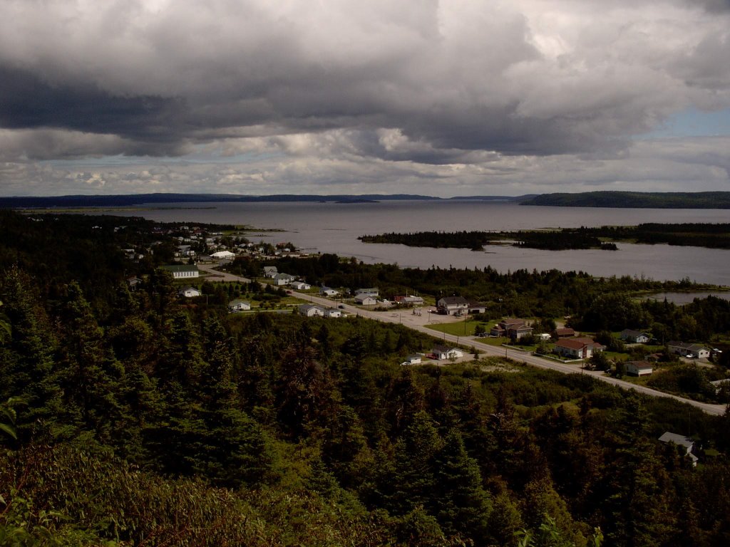
Tuesday August 8 - Another travel day. It was a gray, rainy day as we packed the van and made one final sweep of the cottage. We left a note for Judy, to thank her for a great vacation experience. We were on the road early -- before 0900, I think.

The rain intensified as we headed south. We also began encountering large RV's on the road, apparently traveling as a group, each one towing a smaller SUV. For the first part of the drive, RV's on the road would be a frequent encounter each hour.

Breakfast was at Tim Horton's (a consistent culinary theme on this holiday) in Deer Lake, and then we began the long eastward trek to retrace our steps on the Trans Canada. By mid to late morning, we had gotten out from under the weather front -- ahead were gray skies that were getting progressively lighter. The dark clouds were behind us.

We made Gander by early afternoon, and again for reasons similar to the first occasion, had a return bout with lunch at Jungle Jim's. Having done the drive in the other direction, we now had some sense of the magnitude of the trip, so we decided to spend some time in Gander. And in Gander, where else but at the Aviation Museum would tourists go? It helped that the Museum was just across the highway from the restaurant.


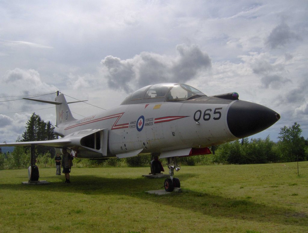
Parked on the lot, off to the side of the building, we saw an ex-Canadian Air Force CF-101 Voodoo -- a 1950s vintage interceptor, replaced by the CF-104 Starfighter, which in turn was replaced by the current generation CF-18 Hornet. There were other aircraft parked outside the building. When we got inside, we found one of the exhibits to be a DC3 cockpit replica, done by grafting the forward section of a DC3 fuselage, including the cockpit area, onto the back of the building. There were many other models, exhibits, and displays in the museum, which appeared to be a converted warehouse.


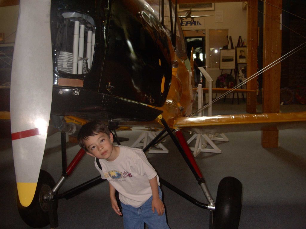
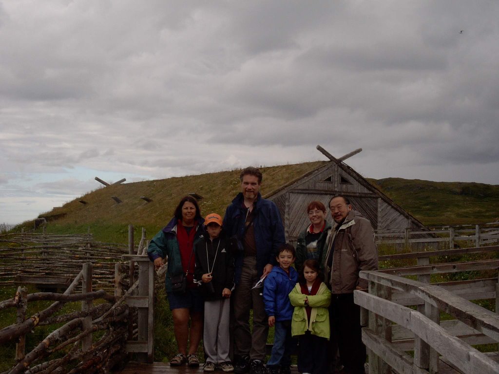
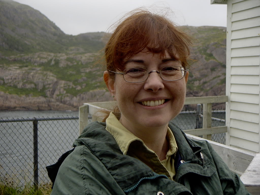
Corwin and Cameron found airplane toys. Robin found interesting places to crawl into and hide. The photo above shows Corwin beside a Tiger Moth biplane.

We also found some computing history -- an old PDP-11 computer -- as large as a wardrobe cabinet, with much higher power demands than fridge, and not a lot of computing power in today's terms. The sign beside the PDP-11 indicated that it had been in service at the Gander airport for over twenty years, and retired in the early 2000's. The hardware had been obsolete when it was brought into service!

Among the exhibits, there was a plaque for No. 10 Bomber Reconnaissance Squadron, as follows:

No. 10 Bomber Reconnaissance Squadron (10BR), known officially during WWII as "The North Atlantic Squadron", was originally formed at RCAF Station Trenton, Ontario, in June 1937. During the next two years, it was stationed at Ottawa, and the Calgary, where it remained only until August 1939, when it was moved to Dartmouth, Nova Scotia.

Mobilized on September 10th, 1939, and equipped with Douglas Digby B-18 (DC-2 Bolo) aircraft, 10BR conducted anti-submarine and coastal patrols from Dartmouth until June 1940, when "A" flight moved to Gander and the remainder of the Squadron joined it shortly afterward. It continued to use the Digbys for three years until they were replaced by Lockheed Liberator (B-24) aircraft in April 1943.

10BR Squadron established a record with attacks on 22 U-boats, including 3 sinkings. During the war, it flew 3414 sorties and lost 7 aircraft, with casualties of 24 crew. It moved to RCAF Station Torbay in June 1945 and was disbanded on August 15th, 1945.

Researched by William Sullivan, Gander

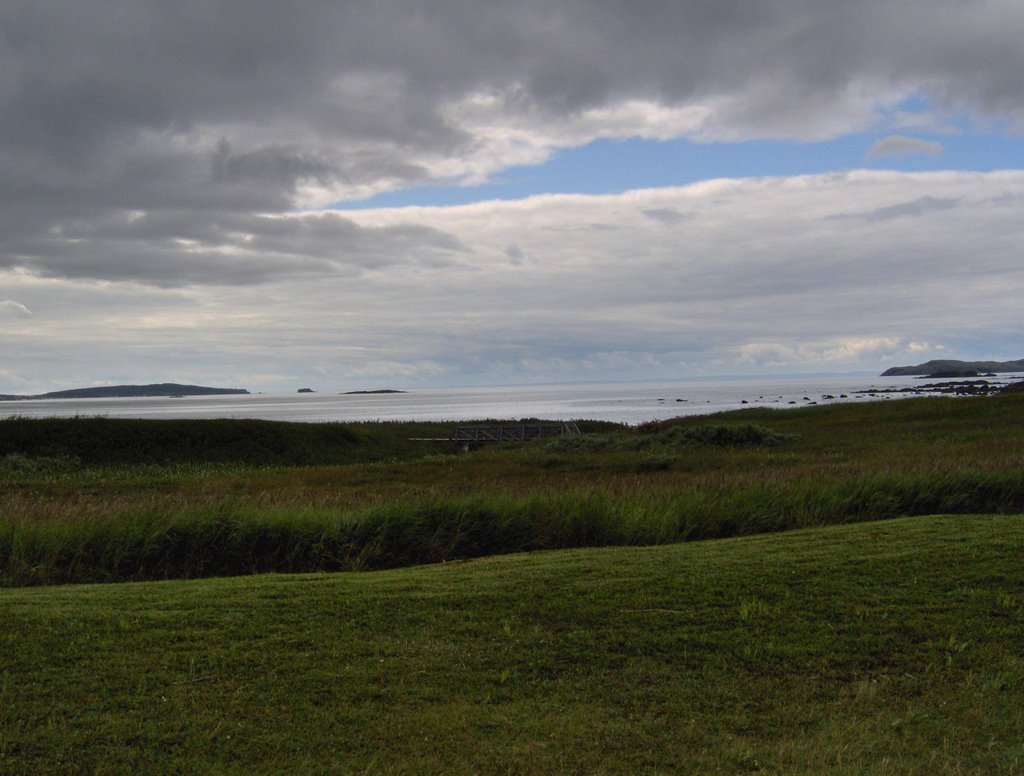
The stop in Gander was a nice break. We continued eastward by mid-afternoon, crossing onto the Avalon Peninsula and passing the first turnoff for Cape St. Mary's just before sunset.

It was dark when we got to the hotel. We got the children settled with Liza, and then Chris, Jill, and I went back out with a luggage cart to complete the unloading of the van. Toward the end of loading the cart, we were all distracted by the task of climbing in the van, putting the middle seat back up, and looking under all the seats to see whether there was anything that small hands had dropped. Moments later, when we finished and looked up for the luggage cart, it had vanished, apparently into thin air. Further searching revealed it across the street -- it had rolled, soundlessly, across the gently sloped parking lot, down the sloping curved driveway, and across the street -- without hitting any other car, or spilling any luggage, or causing an accident with oncoming traffic.

Dinner that night was take-out Chinese food from the Magic Wok. We packed the children in one room in front of the tube, and had a blessedly civilized adult dinner and conversation in the other.

Wednesday August 9 - Back to Signal Hill. And this time, we got in to the Cabot Tower, although it closed (again due to wind) during our visit.

We went down to the Visitor Centre, and left the van there while we made the short hike to the Queen's Battery.


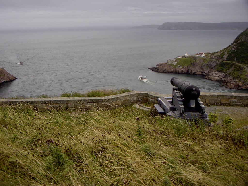
It was obvious why the site had been selected -- from this vantage point, the cannons of the coastal battery had a commanding view of the Narrows. It was not too difficult to conclude that any halfway capable gunnery officer with competent gun crews would be able to place a shot onto any spot inward of the Narrows -- a sobering prospect for any admiral leading an invasion fleet which, of course, would have needed to sail through the Narrows and past the Queen's Battery.


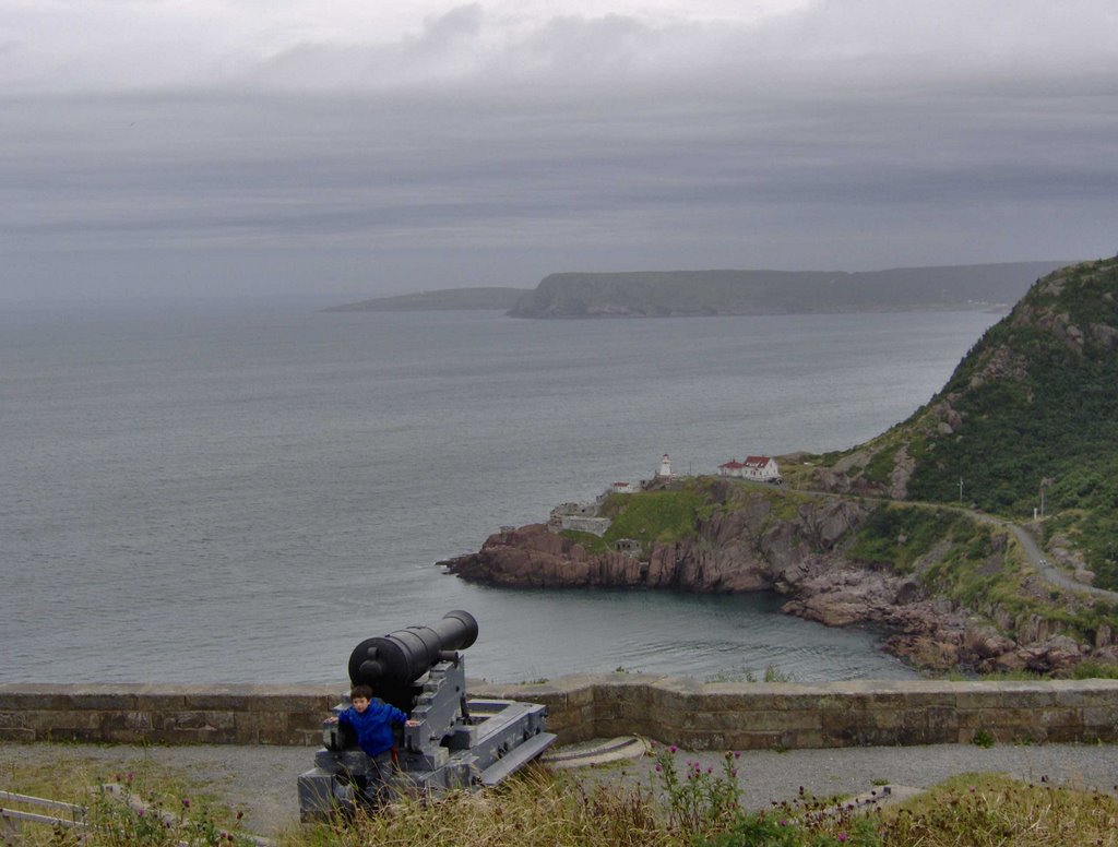
The cannons made a great playground for the children. However, with complete disregard for their historical significance, my son sat on one of the carriages, with the cannon looming over his head, and pretended that he was piloting a Star Wars hovertank in the Clone Wars.


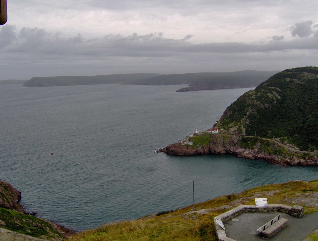
From the Queen's Battery, Fort Amherst, on the other side of the Narrows, was much more clearly visible than from the top of Signal Hill. (A day without fog, and zoom settings maxed on the camera didn't hurt, either). We drove around the harbour to the other side for a first hand look.

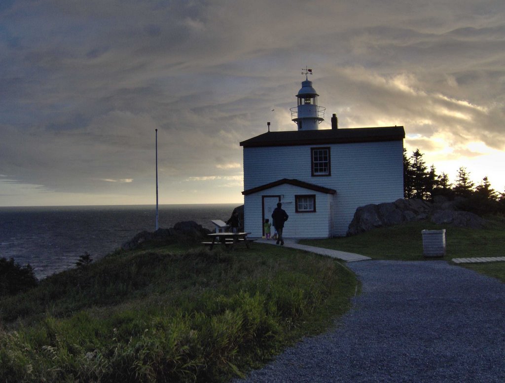
Fort Amherst was built in 1777. There is nothing left of the original fort, although there are crumbling World War 2 concrete bunkers and an old lighthouse. The road leading to the fort is also the location of private houses, all nestled on the rocky slope beside the road.


Two views of the Narrows above from the Fort Amherst side: without a ship passing through to show the passage, and with a ship to show how narrow the passage actually is.

In the photo, the ship was (we think) a supply vessel from one of the offshore drilling platforms. But many ships going far back into history have sailed into the harbour through the Narrows. Make the ship gray and longer and put guns and depth-charge launchers on it -- a World War 2 Canadian corvette returning from mid-Atlantic convoy escort duty. Make it a three masted schooner or man-o-war -- the ship of Captain James Cook arriving in the Colony of Newfoundland, a stop enroute to the Caribbean or to points farther south beyond the equator.


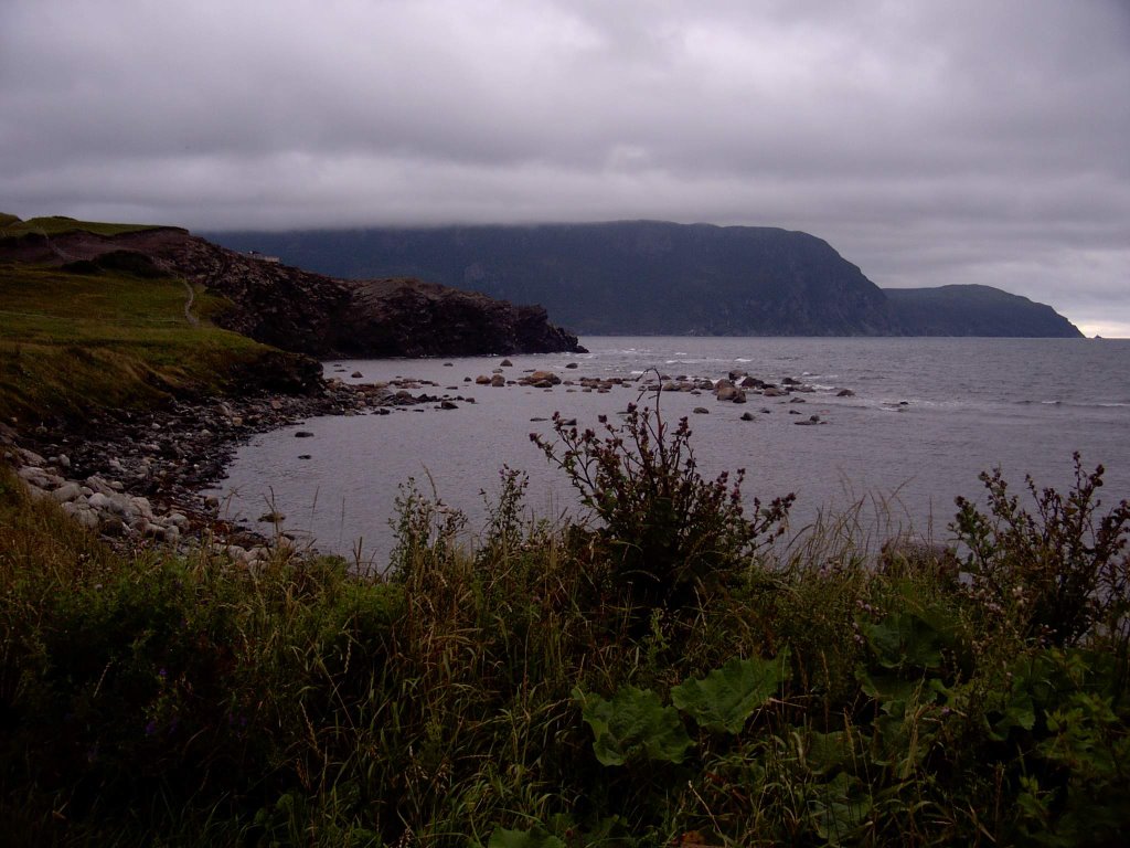
Thursday August 10 - Our last full day in Newfoundland. If we were to make it to Cape St. Mary's, today would be the day. This proposal was vetoed on the grounds that hours of driving (about two and a half to three hours each way) would not be good for the kids. A second independent survey conducted with Corwin confirmed this view.

Seeing Cape St. Mary's again was one of my personal objectives for this trip, and I didn't want to give it up that easily. After a quick discussion with Jill, I went through the Yellow Pages and called every car rental company (including Rent A Wreck) in St. John's to see if I could rent a car for the day, and at least go myself. To my surprise, horror, and disgust, no one -- no one! -- had anything available. I did find a bus service that would get me to St. Bride's, close to Cape St. Mary's, but I was unclear on whether the bus service included a return trip the same day.

Having exhausted all options, I regretfully bowed to the inevitable.


A walk through downtown St. John's, lunch, and a trip to the railroad museum was the order of the day.


That afternoon, I looked after Corwin, Robin, and Cameron while Jill, Liza, and Chris did some shopping along Water Street. While they were gone, Erin and a friend dropped by, to bring us back our shipping box which they had kindly taken away and stored for us for the last week.

That afternoon, both Jill and I, and Chris and Liza, went through the exercise of packing away books and clothing and miscellania in two shipping boxes (Jill went out to get a second one). Late afternoon, one box (the one which had been mailed here originally) was taken to the post office and mailed. The second would be part of our checked luggage going back.

Around the same time, I discovered that I had left two books behind in Norris Point, so I e-mailed Judy from the hotel to ask her to look for them.


Our last dinner in Newfoundland was at the Magic Wok (decided through a best out of three coin toss -- the other possibility was the Keg).

Friday August 11 - The morning of our departure was sunny, with a light scattering of clouds. After breakfast in the hotel, we loaded the van and checked out. From Le Marchant Street, we went down to Water Street, passing an EU Fisheries Patrol vessel called Jean Charcot tied up at the pier.


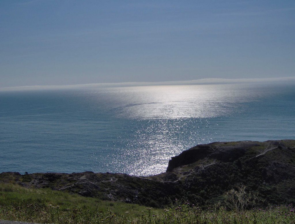
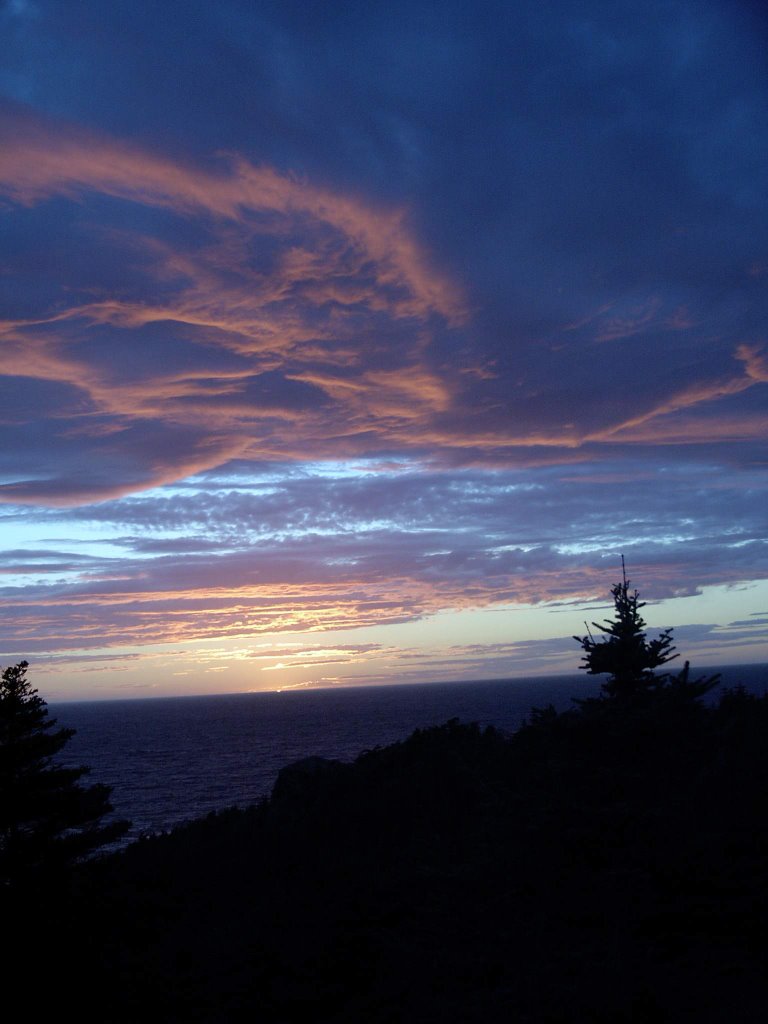
When I worked here in '97, my tradition was to go up to the top of Signal Hill every time I left for the airport, and start my trip home from there. I was happy that this tradition would continue. Early morning, at the top of Signal Hill, the combination of sea, sky, and sunlight was very peaceful.

We did something new that morning -- we climbed down the stairs on the seaward side of the Cabot Tower -- over a hundred of them, down a very steep slope. From there, we walked out to where the soil and ground cover ended and there was only bare rock.


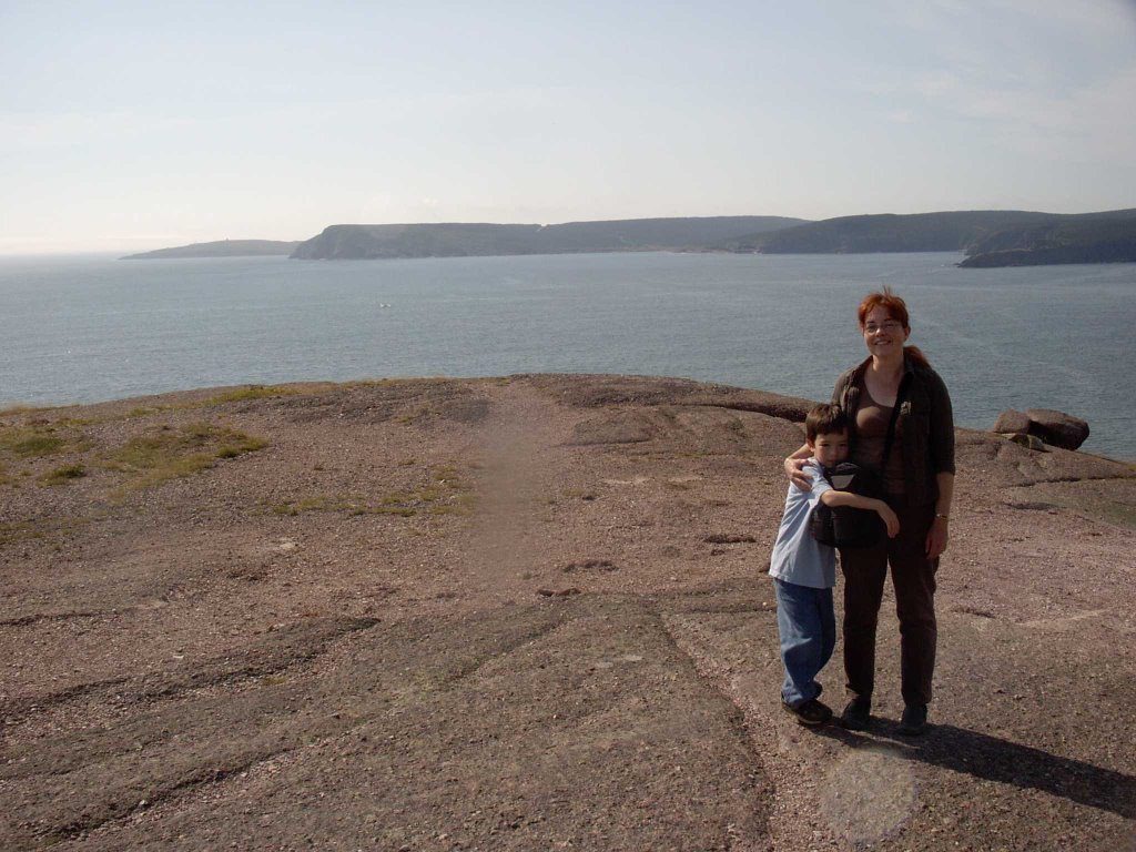
Here, we paused for a few minutes to enjoy the sun and the water, and to reflect on what a great vacation it had been.

It was a long climb back up to the parking lot -- over a hundred stair steps, but this time we were climbing up. Robin had to be carried for the last half. I deeply envied her.

We delayed in downtown St. John's for a few minutes longer, reluctant to leave. We took some more photos -- of houses, of the NewTel office facility behind the Hotel Newfoundland, of the harbour. Eventually we made our way to the airport.

We unpacked the van onto two airport luggage carts. I returned the van to the car rental compound, dealt with the paperwork, and went in search of my family, duly finding them in the Air Transat check-in lineup.

The previous day, there had been a security incident in the UK. The consequence of this incident was that the transport authorities were not allowing liquids to be carried on board aircraft. As a result, Jill had to give up her eyedrops and lipstick. Liza had to give up Robin's anti-histamine medication. After we cleared security, Jill and Corwin and I were called back, because they were concerned about the individually blister packed Gravol pills in Jill's purse. (They let us carry them through). For our group, these measures were a minor annoyance, but I understood that the were massive delays in the air transport system over the next few days.


It was also clear that these measures also equated to what security expert Bruce Schneier calls "security theatre" -- a knee-jerk response for the sake of demonstrating a response with no plan behind what goals the response was supposed to accomplish.

This became evident on the plane. One of us ordered a "tuna kit" for lunch for $5. When the flight attendant brought it, we all burst out laughing -- the tuna kit was a can of tuna salad with crackers, all packed together in one air tight package. The can opened with a pull tab that would allow the user to remove the entire metal lid. Once removed, of course, the metal lid with its sharp edge could have been converted to a much more effective weapon than all of our confiscated antihistamine, eyedrops, and lipstick put together.


After an uneventful flight home followed by a lengthy delay in getting our luggage, we arrived back home.

The memorable Newfoundland vacation was over.

Epilogue

Wednesday, November 22, 2006

What We Did Last Summer -- Part 3 -- Rolling of the Sea

Continued from Part 2.

Tuesday August 1 to Wednesday August 2 - With breakfast-enhanced wakefulness, we loaded up the van and after a last farewell tour through the water front (resulting in a planned delay of 15 minutes) we hit the Trans Canada Highway headed west. With all the practice we had over the last few days, we had no trouble staying on the correct route.

In short order, we passed the turn off to Kevin's cottage at Middle Gull Pond. From this point onward, this was road that we had never, as a group, seen before. The day was perfect for driving -- clear but with just enough cloud cover so that there was no bright sun glare.

We were traveling with three children, so rest stops were frequent. The first of these, about half way between St. John's and Terra Nova National Park, made me briefly nostalgic for my childhood in northern B.C. The place was a store, a restaurant, and a gas station beside the highway. If you right-click on the image, select "Save Link As" and save the picture, then load the picture using a utility like ACDSee and zoom in, you can see Chris in the van tweaking his GPS device.


There is only one road through Newfoundland, so we had no choice but to follow the twisty route of the Trans Canada. Many roads led away from the highway toward the northern coast, to little coastal villages. Even with the highway, there are still Newfoundland outport communities that can only be reached by seaplane or by boat.

This was not the case of Gambo, where we made another rest stop. Gambo is right by the highway, and its claim to fame is that it is the home town of Joey Smallwood, the Newfoundland politician who presided over Newfoundland's entry into the Canadian Confederation in 1949.


Lunch was in Gander in the early afternoon. In order not to traumatize finicky palates, we ate at a chain restaurant called Jungle Jim, whose only virtue was that the children liked it.

We also filled the tank again in Gander. The gas price per litre in St. John's had been around $1.20 per litre -- compared with a price in the mid to high 90s back home in Toronto. We had been braced for even worse sticker shock on the highway, but the price was about the same. After a second refill late in the afternoon, we eventually reached Deer Lake, and less than an hour after that, we reached the edge of Gros Morne National Park.

By this point, we had been on the road for over nine hours, and fatigue levels were getting high. A combination of games, comic books, books, strategically doled out snacks, and games played on the PSP or my Palm kept the children more or less harmlessly occupied. However, there was some inevitable conflict, even though all three children were real troupers through what was a long and grueling drive. There was one funny moment when after a brief spat, Robin's voice rang out in the sudden silence : "Things would go so much better if you people would just do what I want."

Our ultimate destination was right on the western coast, a community called Norris Point, close to a slightly larger place called Rocky Harbour. Both towns were surrounded by the Gros Morne wilderness -- a land of rock and high cliffs, forests, and the ever-present sea close by.

Months previously, we had planned for a week in Gros Morne, and through the magic of the internet, had found Judy Reid and "Reid's Tourist Home" -- our home away from home for the next week in Norris Point. Judy wasn't available the day we arrived, so she had arranged to leave the cottage unlocked so we could get in.


This "cottage" was actually slightly larger than our house! Clean, neat -- it would have passed much stricter standards than those of a slob like me.


The road leading to the cottage was called Neddie's Harbour Road. It had followed the edge of a harbour, which we assumed to be Neddie's Harbour, and beyond the cottage, it disappeared over a hill. A few days later, Chris and I and the kids walked along the road to find a small graveyard, a gravel pit, a small wood cutting operation, and a water treatment plant.


But the first night was a night to wind down. Relaxation was facilitated by the fact that the convenience store next to the Esso service station at the beginning of Neddie's Harbour Road was also a beer store. Snacks, beer, and barbecued pork chops went a long way to restoring good cheer after the long drive.

The next day, our first full day in Norris Point, was taken up with administration and research. After a long sleep, followed by a leisurely breakfast and lunch, we drove out to the Visitor Centre to get maps of the park, and then into Rocky Harbour in search of a laundromat.

As we turned from the road from the Parks Canada Visitor Centre onto the road going to Rocky Harbour, we saw a moose beside the road -- we were less than two road widths away from it. It chewed its plant fodder oblivious to our frantic photography.

In Rocky Harbour, we found the laundromat, and restocked on groceries. Liza and Jill found a place which sold crafts and souvenirs. That evening, we ate dinner at a restaurant called Jackie's, where I ate real Newfoundland cod.

Once we got to the shore, it was also obvious why the community was called "Rocky Harbour". Rocks littered the harbour, carried there by glaciation during the last ice age.


Thursday August 3
- On our second full day in Gros Morne, the objective was to visit a little piece of Mars on Earth.

The place we needed to initially get to was (theoretically) visible across the harbour, a place called Bonne Bay. From Bonne Bay, there was a road that led to Trout River. Lacking a car ferry to take us and our faithful van across the harbour, we instead backtracked thirty or forty kilometers to a point outside the park, to pick up the road that got us around to the other side of the harbour to the road to Trout River Pond.

We got there in time to have a quick lunch (sandwiches in a covered picnic area) and make the early afternoon boat tour.

In one of the local variations of meaning, the word "pond" in Newfoundland is a reference to a lake. This linguistic evolution is probably reasonable when one considers that Newfoundlanders, faced with the reality of the North Atlantic, are not at all impressed by any other body of water.

Trout River Pond was a fjord which became landlocked as a result of geological reshaping during one of the Ice Ages. The cliffs which border it are very important for insight into the forces which have driven our planet's geological evolution. On one side, there are familiar granite cliffs, such as one might see in Northern Ontario. On the other side side, the cliffs start as normal rock, but there is a transition point, and beyond that point they are mostly bare of any growing thing, and they have an orange-yellow colour. They are composed of peridotite, a mineral that normally exists deep in the earth, typically at the depth of the Mohorovicic Discontinuity, which marks the boundary between crust and mantle layers in the Earth's structure. This part of Gros Morne is known as the Tablelands.

The day was cloudy, with occasional periods when the sun would shine. It was quite cool on the boat -- we were all glad to have brought sweaters and jackets. The boat itself was a slightly larger version of the whale watching boat that we had encountered a couple of days previously. It was also obvious that the tour operators were old hands at this -- the tour ran smoothly, and the commentary was well done.


The transition from "normal" rock to peridotite was quite abrupt. Normal rock weathers, and is subject to erosion by natural forces, including biological activity -- plants take root, and in the process create more soil on the rock and in cracks in the rock, allowing further generations of plants to grow. And eventually, an entire ecosystem develops on the mountain or cliffside.


Not so with peridotite. Although peridotite is subject to erosional forces due to wind and water (in fact, it wears away more easily than granite does), nothing grows on it, because it is toxic to plants. The toxicity is due to the presence of heavy metals. Very hardy plants have taken root, in crevices filled with wind-blown soil, but these are rare, and when found, they are small and spindly.


After the tour, on our way back out toward the main highway, we stopped at a place where the road formed a divide between the two kinds of Tableland rock. The stark, lifeless, yellow orange landscape, lit by a cloud attenuated sun, was unearthly. It is almost certainly the closest that I will ever get to a first hand look at the surface of Mars.


Olivine is a component of peridotite -- a substance which has been verified to be present on the Martian surface by both Spirit and Opportunity. In the Tablelands, the peridotite originated in the Earth's mantle. The Tablelands were formed when two continental plates collided, causing material from deep within the earth to be upthrust. Gros Morne and the Tablelands provide fine examples of the result of this ancient geological activity for study, one of the reasons why it was designated as a UNESCO Heritage Site, in addition to being a National Park.

On our way back to Norris Point, on the main road (Highway 430), we encountered a pair of moose beside the road -- a mother and her calf. We stopped to take photos, and over the course of ten minutes or so, four or five vehicles stopped to join us. The moose eventually slipped into the forest, and we continued on back to Norris Point.


Friday August 4 - With the weather forecast showing that Friday would be reasonably clear, we decided to make the long trip up north to L'Anse Aux Meadows. We were on the road just after 7am, which was a bit of a struggle. We passed through all of Gros Morne, following highway 430 northward to the very northern tip of the island of Newfoundland.

When I got the tire repaired earlier in the week, I had gotten a set of "moose whistles" from the outdoor section of the Canadian Tire store, in anticipation of driving in Gros Morne and the west coast. Before starting that morning, Chris and I fastened them to the van with packing tape. On the way up north, we passed through a coastal community, and saw two moose ambling through an industrial area beside the highway. This was our first, but by no means last moose encounter of the day.

Including rest stops, the trip up took about four hours. In the last part of the drive, highway 430 paralleled the Newfoundland coast. We could see Labrador, ten or fifteen kilometres away across the Strait of Belle Isle.

For personal and cultural reasons, I have always liked to seek out and eat in Chinese restaurants in small communities when I travel. It is the whole reliving my past thing, since Chinese restaurants, after all, reflect my personal roots. However, on this occasion, I was outvoted. We had lunch at the Tim Horton's in St. Anthony. From the promotional place mat on the table, however, I learned that there was not one, but actually two Chinese restaurants in St. Anthony.

After lunch, we made our way north back along 430 to its intersection with Highway 436, and followed 436 to the coast, to the National Park that enclosed the L'Anse Aux Meadows site.

L'Anse Aux Meadows is not very far north -- at least, not according to the standards of someone born in Northern B.C. It is at a latitude that puts it at same or a bit south of the latitude of Moose Factory, Saskatoon, Edmonton, or Prince George. But north of this point (not quite the most northerly point of the island of Newfoundland), there is nothing but water -- the North Atlantic eventually becoming the Arctic Ocean.


It was here, around the year 1000 -- 500 years before Columbus and John Cabot -- that Vikings made landfall on the North American continent and built a small settlement. This discovery was made in 1960 by the Norwegian explorer Helge Ingstad and his wife, archaeologist Anne Stine Ingstad. The commemorative plaque, a corner of which is seen in the lower right hand corner of the photo, reads as follows (also in French)-

ANNE STINE AND HELGE INGSTAD
REDISCOVERING THE AMERICA OF THE VIKINGS

A GIFT FROM THE PEOPLE OF NORWAY
UNVEILED BY H.M KING HARALD V ON MAY 11, 2002

SCULPTOR: NILS AAS. THE STATUE IS A REPLICA OF THE ORIGINAL,
WHICH STANDS NEXT TO THE ENTRANCE OF THE
VIKING SHIP MUSEUM IN OSLO. THE ORIGINAL STATUE
WAS UNVEILED ON JANUARY 25, 2001 BY KING HARALD V
IN THE PRESENCE OF HELGE INGSTAD.
THIS GIFT HAS BEEN MADE POSSIBLE THROUGH THE SUPPORT OF
NORSK HYDRO AND THE ROYAL NORWEGIAN
MINISTRY OF FOREIGN AFFAIRS.


Between 1961 and 1968, an international team of archaeologists led by Anne Stine Ingstad excavated the remains of sod houses, artifacts, a forge, various work areas, and firepits. All of these dated back to a 15 to 20 year stretch around the year 1000 when Vikings, travelling from their existing settlements in Iceland and Greenland, would have periodically inhabited this site.

All that remains now, a thousand years later, are ridges and depressions marking the former location of walls.

The archaeological site is well maintained, complete with metal plaques identifying individual building locations. Off to one side, away from archaeologically interesting spots, there is a recreation of a Viking sod house, with two historical interpreters inside dressed in appropriate costumes. Chris and Cameron tried on Viking helmets, and were allowed to handle spears, shields, bows, and arrows.


A thousand years ago, the scene above is what the Vikings would have seen as they looked out to sea from the shore of their settlement. For purposes of this photo, just assume that the Viking longboats are drawn up on the beach, off to the left, and not visible in the image.


Like the rest of Newfoundland, this coast was very rocky, leading to the acidic soil conditions that are ideal for blueberries. In fact, in the ground cover off the walkways, there were many blueberries, and in the photo above, you see my son foraging for them, with the Parks Canada visitor centre/museum in the background.


We left the L'Anse Aux Meadows archaeological site and went a couple of kilometres further down the road, to Norstead -- a recreation of a Norse trading port. Norstead is a simulated Norse community -- complete with animals, and interpreters in costumes. There were also replicas of artifacts -- made from wood or bone or wool or even metal, by hand, using original techniques.

The group shot above is courtesy of a passing fellow visitor just outside the sheep pen.

Norstead had another sod house, probably a little less authentic because of the extensive amount of wooden timbers used in its construction. We saw bushes and ground cover, but no mature forest. The unanswered question for me was whether there originally would have been trees for timber, and whether the current lack of trees was due to modern logging? There was also a church (the Viking travelers of the year 1000 would have been recent converts to Christianity, some still secretly worshiping Odin and Thor), a smithy, and a boat shed which held the Snorri -- a replica Viking longboat which made the crossing from Greenland to L'Anse Aux Meadows in 1997/1998.


Norstead also had a rocky beach down from the boat shed -- we found an assortment of shells (mostly mussels), an eviserated crab (above) probably caught and eaten by a seabird.

Norstead closed late in the afternoon, and we were among the last to leave, along with the staff. We had dinner (more cod for me), and then headed back south. Sunset was around 8:00, with progressively deepening twilight over the next hour. On the drive back, Liza and Jill counted more than a dozen moose beside the highway -- none close enough to present a danger, but nerve-wracking nonetheless. Based on experience and observation, our collective belief is that the moose whistles don't work.

Sometime after 1:00 in the morning, we pulled into the driveway of our home away from home in Norris Point. The night was clear and quite cool. On the deck, looking northward, I saw Ursa Major shining in a sky filled with stars normally invisible in the city. A bright meteor made a sudden streak across the sky. Sadly, this was the only clear night that stargazing was possible, and we were all too exhausted to do anything about it.

Saturday August 5 to Monday August 7 - The next three days were devoted to exploring more of Gros Morne, Norris Point, and Rocky Harbour. Saturday afternoon included a trip to the Bonne Bay Marine Research Station in Norris Point, an hour hanging out with the children in a playground, followed by dinner in Rocky Harbour.

Following the road through Rocky Harbour north along the coast (thanks to Chris' GPS device and set of PalmPilot maps), we reached Lobster Cove Head. From the cliffs here, we could look south and see Rocky Harbour. The cliffs also provided the vantage point for the lighthouse.


The children climbed the rocks around the lighthouse, while we took advantage of photo opportunities in the scenic surroundings. I have a highly blurred image of something long and sinuous and black (a marten, perhaps?) that raced out of the underbrush and zipped into another clump of brush and trees by the edge of the high fenced off cliff that overlooked the ocean.


Sunset occurred at 19:57:46 according to the timestamp on my digital camera. A fairly substantial group of people (20? 30?) gathered to watch the sunset - some locals, others tourists like us.


On the following day, our travels took us to the site of the wreck of the S. S. Ethie, one of the ships of the "Alphabet Fleet" of Sir Robert Reid. The ship went down in an ice strom in 1919, with no loss of life. Remains of the engine and boiler are still on the beach, the rust softening sharp edges, and the pieces slowly crumbling into oblivion.


We paused briefly at a scenic lookout point beside the highway where we could see the Western Gap, marking a passage into the Long Range Mountains. These mountains are an extension of the Appalachians which extend all the way through to Tennessee and Alabama in the United States. They are ancient -- dating back almost 700 million years when various continental plates came together to form the supercontinent of Pangaea.


After lunch, we went to Western Brook Pond. We found an immense sandy beach, almost deserted, sandwiched between a stream meandering to the shore of the ocean, and the ocean itself. The sand dune environment here is quite similar to that of the Pinery Provincial Park in Ontario -- not a place that Jill or I have any experience with, but quite familiar to Chris and Liza. Walkways had been constructed through the dunes, and marran grass and trees planted to hold the dunes in place. Even so, the dunes are unstable -- disruption of a strategically located bit of ground cover (by, for instance, a careless foot) might result in the wind over time carving away the dune.

While there, I found some bones in the water -- the freshwater river side, not the ocean side. This is my "CSI" photo, complete with my trusty pen to establish scale. What was it? There are vertebrae, what to my untutored eye could be a pelvic bone. I am thinking this is the remains of someone's barbecue, or perhaps a small animal that was killed and eaten by a fox.


Monday was our last full day in Gros Morne. Our intention was to go back to the sandy beach of Western Brook Pond. We were disappointed by the extreme wind. At Shallow Bay and Cow Head, at the northern end of Gros Morne park, we encountered wind so extreme that it was possible to lean into it and be supported by it. The wind combined with a sandy beach would not have been a pleasant experience.

Instead, we explored Cow Head - walked up to the lighthouse at the top, and back down again. At one point, we found a wide expanse of grass, which combined with the strong wind allowed Liza to have her "Sound of Music" moment.


Returning from the top of Cow Head, we encountered a pair of birds -- a mated male/female pair, obviously trying to distract us from something important close by.


As we left, we took a photograph that we knew our friend Lorna would appreciate.


The moon shared the sky for our last sunset in Gros Morne -- it had been a memorable week.

Continued in Part 4.