
The Hinode satellite captured images of the eclipse from space. Hinode is a joint science mission (also known as Solar-B) mounted by JAXA, the Japanese Aerospace Exploration Agency, and the American NASA. The following image (photo credit NASA/JAXA) shows the moon's shadow in front of a heavily filtered view of the Sun.

Another Japanese Earth-monitoring satellite MTSAT captured what I believe has to be one of the most seriously cool space images ever -- the view of the moon's shadow on the earth from geostationary orbit 35,790 km (22,240 mi) high. The image (photo credit MTSAT/GMS via Wired Science blog) shows the shadow covering the island of Taiwan. Note that Australia is pretty clear of cloud cover -- just as one would expect from the reports of drought conditions there.

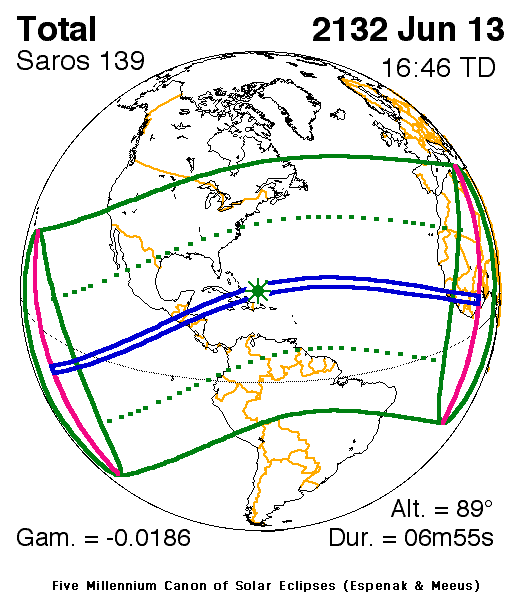
As eclipses go, this one was pretty long at nearly 7 minutes of totality. The next one having this comparable level of totality won't occur until 2132. Those of us still around will be just a bit decrepit by then :-)


No comments:
Post a Comment